Sunday was a beautiful day for a hike. I started out near the Maintenance Area of the reservation and headed up the Quarry Trail to the Middle Loop Trail. From there it was up Tote Road to the Ski Area.
I then hiked the access road to the UMASS wind tower, then headed on to Dead Top. From there i headed north along the MM Trail to Whiting Peak then back down to Free Orchard. Total hike time was around 2 hours, 40 minutes.
Frog Pond off Quarry Trail near Long Loop trail.
Heading east towards the D'O C and Keystone Trails junction.
Basalt rock formation off of Middle Loop Trail heading southeast towards Tote Road.
A quiet, peaceful section of forest near Tote Road.
Yellow cracked Bolete half way up Tote Road.
Heading up Tote Road towards the Mt. Tom Ski Area.
There are still a few structures remaining that bring back memories of the Mt. Tom Ski Area.
I traveled far to see the face of God.
On the road to Dead Top.
The abandoned UMASS wind power experiment.
The Basalt cliffs of the Mt. Tom Range looking northward.
Basalt shale on the west side of the mountain.
One of the many species of wild flowers growing atop the mountain.
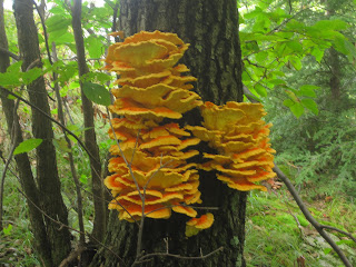
Northern Tooth growing on trees near Whiting Peak.
Physical Graffiti atop of Mt. Minus. Graffiti is still a problem all along the MM trail.
Heading back towards Free Orchard.
Mt Tom Reservation Maintenance Area.


