
lending it historic roles in the American Revolution.
 Signal fires on the mountain gave both it and the city their name. In 1901 the local chapter of the Daughters Of The American Revolution erected this monument at the site of the original signal fire near the summit of North Beacon Peak.
 A plaque commemorating the rededication of the memorial on it's centennial July 4, 2000.
 Repair/Rebuilt plaque.
 Here's the main T.V. transmission complex, next to the D.A.R. I asked Roberta if the building on the right was once a private home, but she said it was always part of the T.V. property.
  One last look at the tower before heading to the D.A.R. monument.
Mt. Beacon South Peak
 Another spectacular view of the Newburgh Bridge looking northwest.
 I asked Roberta about this peninsula and she said it was once an island but had been filled to join the shoreline, i also forgot the name of it, but it's located in Fishkill, New York just south of Beacon.
 This picture is interesting because before i took it, i looked through my binoculars and to the right of the Hudson River in the middle of the picture, i could make out the New York City skyline through the haze. On clearer days you can see the skyline perfectly, which is 59 miles south of Beacon. Helen joked how people from New York City refer to Beacon as "Upstate New York"
 These are the main T.V. towers just southwest of the Northern summit.
 Looking Northeast from near the Fire Tower.
The Fire Tower


 The Fire Tower was built in 1931 on the site of an earlier, possibly wooden structure and was used by the State of New York to spot to spot fires for five decades. The tower stands on Mt. Beacon's south summit. The tower stands 60 feet high and given the summit's elevation of 1650 ft., must boast spectacular views of the Hudson River Valley. Unfortunately, the tower is closed due to restoration, for more info, here's a link:
Fire Tower Here We Come!
 When the hiking party broke up at the north summit, this group embarked on an eight mile hike of the Fishkill Ridge, but somehow got sidetracked after two miles. here they are getting directions from Roberta.
 This flower seemed out of place in a sea of rock. Does anyone know what it could be?
 Tanya probably joking to Roberta "you're too slow...hurry up!" Roberta kept telling everyone that she was too slow, but i don't know... she was always right there, with the rest of the pack.
 The last leg of the trail to the tower was made up of glacier rock, in fact the south summit was just that.
The Road To The Tower
 The boundary of the Hudson Highlands State Park where the Fire Tower is located.
 This area reminded me of the Quarry Trail.
 The road leading to the Fire Tower at the outer edges of Fishkill Ridge.
Where Have I Seen This Before?
 Mountain Park junkyard immediately came to mind.
 Now i was confused, how in the world did these cars get here? Late model ones too!!!
Well the mountain has it's share of T.V. and radio towers and there is a road that is used to maintain the transmitters and buildings. (There is also a road that leads to Beacon Reservoir, another area i wished i could have visited, Jim told me of an interesting tale of what happened there a while back, but it was getting late and the party was tired, perhaps on another visit.) I was told the cars didn't get up there on their own, but were towed up there by heavy duty tow trucks.
 The road to the Fire Tower passes the old cottages that were in use when the hotel and casino
were operating in the summit's heyday. Roberta told me that one of them was still standing, a sort of Victorian styled cottage. On our way back we were going to visit the cottage, but the girls were kind of tired (my legs at that point were heavy as lead too). The next time i visit, i'll make it a point to check it out.
On To The Fire Tower
 The Fire Tower located on the South summit of Mt. Beacon.
 The hike to the north summit was where the original hike was to end, but i overheard that Roberta, the gal on the left, was taking Helen, Pat and Tanya to the South summit for a view of the Fire Tower. I figured i came a long way, so why not make it worthwhile. Roberta by the way has lived in Beacon since the late sixties, and hikes the mountain frequently, she told me she hikes the trails alone, which she says is a little unnerving at times (geez, i wish i lived closer, she would make a great hiking companion) she had a lot of interesting information to share, i thought she was a guide, but she's just another hiker, who happens to know the Beacon like the back of her hand!!! Thanks for a wonderful hike Roberta.
 Another beautiful view looking south-west from the casino ruins.
Mt. Beacon North Peak
 A view of the Hudson River Valley Northward.
 These hikers are enjoying the view near the site where the Casino once stood. Those bikers had to come up the maintenance roads.
 The city on the other side of the river is Newburgh, New York. That's the Newburgh Bridge Interstate I 84 looking west.
 A view of Beacon, New York. The mountain range way in the background are the Catskills.
We're Here!!!
 Helen and Pat getting ready to take a break, don't that walkway remind you of Mt. Tom?
 This was the hiking party that was behind me.
 The Power House is the first thing you see before reaching the north summit.
Almost To The Top

 Like i said before, these pictures though beautiful, don't do this place justice.
 Now they wait for me!
 The trail at this point is steep and rocky
 When i saw this view, it reminded me of Quabbin.
 This guy who was with the party that was about ten minutes behind me came out of nowhere to over take me. See you at the summit.
 Indeed!
Come On The Rising Wind, We're Going Up Around The Bend
 Where did they go? Huffa Puffa...
 The only reason i got in shouting distance to them was because while i was huffing and puffing
they took a break!
 This is where the trail starts to gets challenging.
The Ski Area


 The ski area cuts across the Red Trail at almost the half-way point, there are several trails that branch out, i don't think the concrete foundations were for the chairlift, i was told that the skiers actually used the incline bed for a chairlift, so these could have been for lights or a second lift, i should have asked some more questions, but by this time the guide was no where in sight.
About A Quarter Of The Way
 At this point the guide felt sorry for me, i had been about 200 feet ahead of the lady to his left, but after a huff and puff episode she overtook me.
 Hey! Wait for me!
 The trail now ascends in a zig-zag stairway climb to the abandoned ski area trails (sound familiar)
 First Views Of The Hudson River Valley

 After climbing the stairway, you get your first views of the Hudson River Valley.
 This picture, as you can see in the background, gives you a good idea of the railway grade.
 I was told that the stairs had to be constructed twice, the first time they used concrete, but they began to crumble after a short time and were replaced by steel.
 That's Tanya and her dog Finora leading the way (i'm sure i have the dog's name wrong, anyway Finora loves turkey & cheese sandwiches, i shared mine with her) Tanya lives in Manhattan and is originally from Spain, she told me Mount Beacon is her escape from New York City madness.
 This is the 300 ft. stairway that's the start of the Red Trail. This stairway was built over very steep and rocky terrain, to the right of the stairway is where the incline railway started it's steep ascent to the summit.

 After climbing the stairway, you get your first views of the Hudson River Valley.
Stairway To Beacon
 This picture, as you can see in the background, gives you a good idea of the railway grade.
 I was told that the stairs had to be constructed twice, the first time they used concrete, but they began to crumble after a short time and were replaced by steel.
 That's Tanya and her dog Finora leading the way (i'm sure i have the dog's name wrong, anyway Finora loves turkey & cheese sandwiches, i shared mine with her) Tanya lives in Manhattan and is originally from Spain, she told me Mount Beacon is her escape from New York City madness.
 This is the 300 ft. stairway that's the start of the Red Trail. This stairway was built over very steep and rocky terrain, to the right of the stairway is where the incline railway started it's steep ascent to the summit.
It is also the closest the Red Trail comes to the incline bed until you get to the Power House on the summit. (The Red Trail loops around the incline rail bed unlike Mt. Tom's incline bed which is it's trail, i asked Jim Bopp if many people take the "short cut" up the incline bed instead of the Red Trail, he looked at me with this grin on his face. Then i remembered the average grade of 65% and the 74% grade the last 800 ft. of the incline, some "short cut")
 A few hikers begin their journey, the guy in the black shirt was a guide, as you can see i started out with him around the same time, but after about ten minutes of hiking, i wouldn't see him again till i got to the summit about 50 minutes later. I did manage to see him ahead of me throughout the hike to the summit, but i had to stop every once in a while to huff & puff, so i never could catch up.

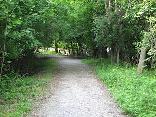
 The bridges cross a brook and are actually an optional route (short cut) to get to the Red Trail.
 The trolley rode to Lower station and the beginning of the Red Trail.
 The entrance to the old trolley road to Lower Station and the pathway to the Red Trail.
 Pictured is Jim Bopp. Jim is a trustee of the Mt. Beacon Incline Railway Restoration Society


 The kiosks had some interesting information on the history of the mountain and railway,
There is a road further up the Red Trail that appears to be a dead end, when i asked Jim about this he said it lead to an area where there was debris of the two cable cars that were destroyed in the fire of 1983.
Pathway To The Red Trail
 A few hikers begin their journey, the guy in the black shirt was a guide, as you can see i started out with him around the same time, but after about ten minutes of hiking, i wouldn't see him again till i got to the summit about 50 minutes later. I did manage to see him ahead of me throughout the hike to the summit, but i had to stop every once in a while to huff & puff, so i never could catch up.
The two girls were Pat and Helen, Pat was from Boston and Helen lived in town though she had lived in Somerville Ma. Helen asked me if i was the guy who owned the red truck with the Patriots stickers, i replied yes, am i going to be shot? (thinking she was a Giants or Jets fan)
she said she hated the Giants, was a Buffalo Bills fan. What a relief!!!

 The bridges cross a brook and are actually an optional route (short cut) to get to the Red Trail.
 The trolley rode to Lower station and the beginning of the Red Trail.
 The entrance to the old trolley road to Lower Station and the pathway to the Red Trail.
Hey!!! I Remembered His Name!!!
 Pictured is Jim Bopp. Jim is a trustee of the Mt. Beacon Incline Railway Restoration Society
and is also the Property Manager of the Mountain. He also holds the distinction of being the last man to operate the Incline Railway in 1978. He's looking forward to operating the railway once again when it's restored. A big thanks to Jim for sharing his expert knowledge of the railway.
Mt. Beacon Park Entrance


 The kiosks had some interesting information on the history of the mountain and railway,
click on the photos for a better look.


1 comment:
hello my name is jan de haas
im a friend of jim bopp
im from holland been to beacon many
times my brother lives there
ive been up the mountain maybe 20 times try to get up the mountain with a lot of ice and snow that sucks
one time i went with jim bopp up the mountain it was so hot they sad on the radio dont go out its too hot
and weve made it i thougt jim was dying . anyway thanks for the story
Post a Comment